Displaying items by tag: environmental justice
Environmental and legal minds will meld at APIEL conference
![1759187412000 093bfdc8 d0ff 4460 bf42 ea5e705c463d 1 edited 1]() APIEL serves as both a legal forum and space for collective visioning
APIEL serves as both a legal forum and space for collective visioning
 APIEL serves as both a legal forum and space for collective visioning
KNOXVILLE — Now in its 16th year, the Appalachian Public Interest and Environmental Law Conference continues to be critical for environmental and public interest advocates across the Southeast. It is hosted annually at the University of Tennessee College of Law, and brings together lawyers, students, grassroots organizers, scientists, and policy experts to address some of the most urgent challenges facing Appalachia and beyond.
This year’s APIEL conference, set for Oct. 25-26, is free and open to the public and features a wide range of panels and workshops centered on environmental justice struggles that expose the interlocking systems of racial, ecological, and economic harm. One focus is the ongoing resistance to a proposed AI data center in Memphis, which threatens historically Black neighborhoods with toxic waste and unsustainable water usage.
Other highlights include a panel on the lasting effects of the Trump administration on the National Park Service and public land policy, a discussion of emerging “climate-washing” litigation targeting corporations making false sustainability claims, and a groundbreaking session titled “Abolition is Ecological.” This panel will explore how justice systems contribute to environmental violence, and how community defense strategies in places like Appalachia are reimagining what true public safety and ecological care could look like.
- 2025 apiel conference
- apiel
- tenn college of law
- environmental justice
- musk memphis
- memphis
- snail darter
- clinch river pollution
- clinch river water quality
- oak ridge pollution
- trump administration
- samantha brooks
- ai data center in memphis
- phil francis
- climate washing
- interlocking systems of racial, ecological, and economic harm
Helene hits the mountains: 600 missing; major roads and railroad links cut; massive recovery underway; havoc in So. Appalachians

KNOXVILLE — The remnants of Hurricane Helene dumped up to 20 inches of rain on the Appalachian mountains along Tennessee’s border with North Carolina, causing historic floods that forced thousands of people to evacuate their homes and shattering records that had stood for more than a century.
The Buncombe County Sheriff’s Office said at least 30 people had died in that county alone; those numbers are expected to climb. CNN reports death toll in NC has climbed to 56; SC 33; GA 25; FL 15; TN 9; VA 2.
MSN reported 600 people are still missing. 85 are missing in East Tennessee since Helene arrived.

For lack of power and water, about 400 offenders had to be moved from the Correctional Center for Women in Swannanoa and the Black Mountain Substance Abuse Treatment Center for Women to other accessible correctional facilities in North Carolina.
In some counties fewer than 10% of cell towers are fully functional.
FEMA Administrator Deanne Criswell is in North Carolina to survey damage alongside Governor Roy Cooper. The Administrator also met with response officials about the ongoing efforts to help survivors in the hard-hit communities. Administrator Criswell will remain on the ground in North Carolina until the situation has stabilized, as directed by President Joseph R. Biden. 3,500 federal personnel helping with search and recovery across Hurricane Helene disaster areas.
The hits keep coming on both sides of the mountains
At 9:24 p.m. Sunday, the regional office of the National Weather Service in Morristown issued a flood warning for Sevier and Knox counties because of upstream water releases at Douglas Dam to regulate the massive surge of water into the Tennessee Valley Authority reservoir system over the past week. This Flood Warning extends until 7:30 p.m. Oct. 1.
 Touch the graph to view its most recent update.
“An upstream floodgate release is expected to continue to cause flooding and evacuations will continue as deemed necessary by local emergency personnel in low-lying communities and neighborhoods along the French Broad River,” according to the urgent bulletin from the NWS. “If you live in a low-lying area near the river and feel your residence may be threatened, please self-evacuate. Continue to follow guidance from local law enforcement, fire/rescue agencies, and emergency management staff.”
 The power of water is on raw display in the Nolichucky River Gorge following devastating floods unleashed by Tropical Storm Helene in northeast Tennessee and Western North Carolina. Jon Mitchell
In a somber video press briefing Sunday afternoon attended by tired-sounding officials from various Buncombe County governments and a Duke Energy representative, Buncombe County Sheriff Quinten Miller shared a “devastating” update: The death toll throughout Buncombe County increased to at least 30. He said search and rescue continues, but recovery footing looms as families continue “grieving tremendous losses.” Little other information was immediately available, such as specific areas where victims may have been clustered.
Thousands of people still need help. A lack of water, telecommunications issues and limited access to affected areas are main problems for the county at this point, officials agreed.
 All roads in Western North Carolina (area shaded pink) still must be regarded CLOSED as per North Carolina Department of Transportation.Touch the map to update it to its current status.
People wanting to donate goods or money to local relief efforts can email This email address is being protected from spambots. You need JavaScript enabled to view it..
The call was sporadically interrupted by apparent cellular issues; Verizon and other telecommunications providers are under increasing fire, with few reasons offered for the near-collapse of cellular service in the region.
The hardest hit communities in East Tennessee appeared to be in Cocke and Carter counties along the Pigeon, French Broad and Nolichucky rivers, according to the National Weather Service.
Nolichucky River floodwaters felled two bridges on Interstate 26 between northeast Tennessee and North Carolina near Erwin.
 Western North Carolina is now effectively cut off from eastbound interstate travel. Tennessee Highway Patrol
Interstate 40 through the mountains was closed at the state line. Authorities said the interstate had been washed out in several places, and it was far too early to tell how long it would take to repair the damage.
 Record flooding on the Pigeon River apparently undermined the ravine between Interstate 40 and the river in the Pigeon River Gorge, causing the collapse of two eastbound lanes in North Carolina near the Tennessee border. North Carolina Department of Transportation
A particularly large mudslide near mile marker 3 on the North Carolina side of the state line apparently swept the eastbound lanes of I-40 into the Pigeon River, and a spokesperson for the North Carolina Department of Transportation said it could take several weeks to reopen the interstate.
Tennessee Gov. Bill Lee declared a state of emergency Friday afternoon as officials estimated that more than 100,000 people in the eastern third of the state had been left without power.
Throughout Western North Carolina, communities were cut off by torrents of muddy water that sluiced off mountains and prompted authorities to declare all major roads impassable.
In Asheville, city officials told the Citizen Times the storm had resulted in fatalities, but didn’t release specifics. CNN reported at least 50 fatalities related to Helene across the Southeast as of Saturday evening; the New York Times reported at least 60 deaths.
Meteorologist Kyle Snowdin of the National Weather Service said Helene dumped around 5 inches of rain on the East Tennessee Valley but weather stations in North Carolina registered between 10 and 20 inches of precipitation.

The event was made worse by a series of thunderstorms that had soaked the region earlier in the week, he said.
In addition to the record-setting rainfall, much of the region experienced sustained winds of 40 to 60 mph that toppled trees and power lines, he said.
Three tornadoes were confirmed in North Carolina.

The Pigeon River in Newport crested at 28.9 feet early Saturday morning, Snowdin said. Previously, the highest water level ever recorded for the Pigeon at Newport was 23.5 feet in 1902.
“We absolutely toppled a very longstanding historic crest,” Snowdin said.
As Helene approached, several aging dams in the region — already near or at capacity — became a great concern to local authorities and downstream populations. This applied particularly to Duke Energy’s Lake Lure Dam on the Rocky Broad River and it’s Walters Dam (locally known as Waterville dam) on the Pigeon River.
 High waters swept away much of Chimney Rock Village, the popular hiking destination above Lake Lure of Dirty Dancing renown. No cell service or power!
 ![]() Van Xan
Van Xan
 Waterville Lake (shown here during a period of low flow) is about halfway between Asheville and Newport. Travelers may notice it along the south-west side of I-4O.
Nolichucky Dam, was of primary concern too because it is also above Newport, toward the east. It was among those dams being closely watched by TVA officials, who issued a series of warnings during the event.
As of Saturday afternoon, a flood watch was still in effect along the Nolichucky due to the possibility the river’s namesake dam could break, said Snowdin.
“We haven’t had any dam failures, but if something like that happened it would be catastrophic, even beyond what’s already occurred,” he said.
When the Pigeon and French Broad rivers overtopped their banks starting early Friday afternoon, the water inundated numerous homes and forced residents of Newport to hurriedly seek shelter from the swiftly rising floodwaters.
Cocke County Mayor Rob Mathis announced at one point that the Waterville Dam in North Carolina had collapsed. Residents fled, businesses closed and inmates from the county jail were moved under armed guard to Sevier and Jefferson counties.
A little over an hour later, authorities determined the purported dam collapse was, in fact, a false report. The evacuation orders remained in effect, however, as sections of Newport were overwhelmed by several feet of rushing water.
The flooding also forced the Newport Utilities Board to shut down its wastewater treatment plant, and a Boil Water Advisory was issued to the district’s customers.
Flood advisories remained in effect for the Pigeon and the French Broad, as well as for Douglas Lake, which receives the waters of all three rivers.
In the small towns of Elizabethton and Roan Mountain in Carter County, the deluge forced scores of residents to seek shelter at churches, schools and other public buildings.
Police and fire departments from several East Tennessee counties responded to urgent requests for mutual aid, sending several rescue teams to the beleaguered communities.
For instance, the Knoxville Fire Department sent eight swift water technicians, and the Knoxville Police Department deployed four officers trained in swift water rescue, as well as three boats.
Transportation was also curtailed in the Great Smoky Mountains National Park, with Newfound Gap Road/US Highway 441 closed along with Little River Road from Elkmont to the Townsend Wye & Wear Cove.
Both the Oconaluftee Visitor Center and Kuwohi Visitor Center were slated to remain closed Saturday while rangers assessed damage to trails and campsites.
The national park recorded 9 inches of rain at Newfound Gap and Cataloochee Creek saw historic flooding with 9.5 feet of water, easily surpassing the 1963 flooding record of 8 feet.
While Knox County escaped the severe flooding seen to the north and east, high winds that downed trees and power lines caused nearly 27,000 KUB customers to lose power.
“Hurricane Helene brought high winds and heavy rainfall to the KUB service area, resulting in widespread and extensive damage to electric system infrastructure,” a KUB spokesperson said in a statement emailed to Hellbender Press late Friday night.
“KUB crews and other resources worked continuously overnight from Thursday into Friday, and have restored power to more than 20,500 customers so far today,” she said. “Crews will continue working overnight tonight and into the weekend until power is restored to all customers. At this time, approximately 6,400 customers remain without power.”
She added: “KUB is not yet able to provide an estimated restoration time as the extensive damage continues to be assessed while crews work to restore power.”
Update 9 p.m. Sept. 28
- The National Park Service and Appalachian Trail organizations are recommending that hikers cancel any attempts to hike the southern third of the trail for the foreseeable future. There are unverified reports that several iconic hiker hostels are closed due to damages and catastrophic flooding, including The Station at 19E and Mountain Harbour B&B in Roan Mountain; The Grove Hostel in Franklin; The Dancing Bear Inn in Damascus; and Uncle Johnny’s Nolichucky Hostel & Outfitter in Erwin. Hiker Ashley Langdon Luke posted an excellent suggestion on an Appalachian Trail Facebook page: “If you still want to come, see if you can find a way to volunteer in one of these devastated communities or reach out to the local trail club to see what they need.”
 Although headwater streams are calming down again, many rivers are still at flood stages, which is particularly true for the French Broad, as shown by North Carolina’s Flood INundation Mapping & Alert Network. As Douglas Lake fills up, levels downstream of it in the French Broad and upper Tennessee may still rise. FINMAN
Touch the interactive map to view the current situation and zoom in or out to explore other areas.
-
Asheville and Buncombe County officials are receiving an overwhelming number of requests for news about missing friends and loved ones. In response, they have created this form. Fill it out and they will do their best to locate missing persons and update you as time and conditions allow.

- Augusta and the entire Savannah River Basin have been devastated by Helene, with numerous road closures and electrical outages expected to continue for a week or more. In response, Savannah Riverkeeper has created this map of the entire region affected by Helene — including all of Southern Appalachia — with layered information about stream height, power outages, first responder locations, gas stations and more.

 This Wundermap from Sept. 28 12:00 a.m. shows that there was still much turbulence at ground level; strong winds coming from all directions.
Touch the map to access the interactive map for the current time and preceding hours.
The original story and updates are below.
KNOXVILLE — Meteorologists at the National Weather Service regional office at Morristown on Thursday (Sept. 26) evening described approaching Hurricane Helene as an “historic setup for the Southern Appalachians that we haven’t seen in decades.”
The hurricane itself, which at about 11 p.m. made landfall on the rural Big Bend of Florida, is already breaking storm-surge and other records. It will have a widespread impact in coming hours and days well inland, traveling north across Georgia into the Tennessee Valley and along the spines and crests of the Southern Appalachians. It is projected to drop prodigious amounts of rain, especially across Western North Carolina, which was under a tropical storm warning at 11 p.m. Tropical storm conditions are possible in Knoxville as the remains of the storm head into the region, according to the weather service.
Helene is already affecting transportation, public works, commerce and personal lives and Hellbender Press will be here to provide as many updates as we can throughout the storm, aggregated from multiple sources. We are focusing on the breadth and depth of the storm as reported largely by citizen scientists and those who share their expertise via social media and use of open-source applications.
Update 9:30 p.m. Sept. 27
 Touch the map to see present alerts.
- Multiple sources report that USA Raft Adventure Resort along the Nolichucky River was destroyed after the river reached unprecedented levels on Friday:
“USA Raft is gone gone,” Katie Prince told Hellbender Press via social media. “The Bridge at Johnny’s is gone. Big Rock is about 30’ underwater. Houses, cars, large propane tanks floating down the river. Gauge blew out at 92,500 [cubic foot per second]; speculation is it reached 150,000 today.”
 Nolichucky River gauge at Embreeville stopped recording at 11:30 a.m. To accurately determine how hight the water level rose will require on-site expert investigation. The all-time record for this location is 24 ft on May 21, 1901. 2nd highest is 21.52 ft, Nov. 6, 1977. However both historic numbers predate the current gauge and are associated with some degrees of uncertainty.
- Mobile homes floating down the Nolichucky River near Roan Mountain. Video provided by Amber Harkleroad Waycaster. She was evacuated shortly afterward. “This is our backyard. Water has a ways to get to us still, but pray guys! We’ve seen water rescue and homes destroyed.”
- Pigeon River at Hartford also flooded rafting outfitters. When the numbers are added up, it could be a dark day for the regional recreational whitewater industry.
- Jon Mitchell of Johnson City said he lost two RVs to the Nolichucky; they were parked near the now-evacuated Unicoi Hospital. He said the level of damage is astonishing. He created a new verb: The area, he said, had been “FEMAd.”
 Residents of Ripshin Ridge near Roan Mountain had to chainsaw their way to main roads. Buzz Trexler
Update 7 p.m. Sept. 27
- Tennessee Emergency Management Agency released this update Friday afternoon:
“Unicoi County Hospital is inundated and patients and staff are being evacuated; however, the evacuations are complicated by the Nolichucky River, which is rapidly rising and full of debris. Local officials in Washington County have told Embreeville residents to evacuate. Hawkins County officials have told residents to shelter-in-place. Northeast Tennessee continues to be impacted by flooding. If you live in a flood prone area, please find higher ground, evacuate if you are told to, and stay informed of the evolving situation. Sheltering locations can be found on TEMA’s website. Many roadways have been impacted by flooding. Before going out, visit TDOT’s SmartWay website.” -
In addition to the landslide affecting Interstate 40 through the Pigeon River Gorge, I-26 is closed. Per NCDOT: “Catastrophic Transportation Impacts In Western NC
“I-40 and I-26 are impassable in multiple locations. All roads in Western North Carolina should be considered closed. Motorists should not travel in this area, should not attempt to drive through standing water, and must respect barricades and road closure signs.”
Update 6 p.m. Sept. 27
- There are reportedly massive floods under way in northeastern Tennessee, including Erwin and Elizabethton. The Tennessee Holler shared video of terrified animals amid extreme floodwaters, and indicated the National Guard may be activated. Patients evacuated Unicoi County hospital.
 Touch the image to view the video.
Update: 5 p.m. Sept. 27
- Carolina Public Press: “Much of the worst damage in North Carolina has centered on Asheville in Buncombe County, the largest population center in western counties and a major convergence point for creeks and rivers.
- “There’s a lot of things underwater right now,” State Sen. Julie Mayfield, D-Buncombe, told Carolina Public Press. “They’re predicting this will be the worst flooding we’ve had in more than a century.”
- “What we are seeing is unlike anything anyone alive has ever seen here in this area,” Buncombe County Manager Avril Pender said at a Friday morning press conference.
- The Tennessee Valley Authority posted this on its X feed: “Tributary lake levels are rapidly rising, especially at Watauga, Douglas, South Holston, Fontana, and Cherokee. Expect high river flows below the dams as we maximize generation and supplement with sluicing and spilling to move this water through our system. Get real-time lake level info: tva.me/ll8o50TxfAb.”
- While most of North Georgia is recovering from Helene, Rabun County suffered major damage. A failure at Mathis Dam caused significant flooding in the south end of the county, and many roads remain blocked. The full extent of the destruction may not be known for days.
- The city of Asheville issued a boil-water advisory.
- Blogger Thunderpig has the latest on WNC power outages.
- The Smoky Mountain News reports that some of the worst flooding in WNC is in the Canton and Clyde areas of Haywood County along the Pigeon River.
- The CItizen TImes reports that Asheville police will enforce a citywide curfew beginning tonight.
Update 4 p.m. Sept. 27
- Helene is now a post-tropical depression centered over Kentucky.
- Chattahoochee Riverkeeper posted this on Facebook out of Georgia: “Parts of the Chattahoochee River Basin experienced major flooding as Hurricane Helene moved across the southeast today. The Chattahoochee River near CRK’s metro Atlanta office has risen by at least 25 feet since Tuesday. The storm has passed, but floodwaters continue rising in some areas. We hope everyone is staying safe and our hearts go out to all who have been impacted by the storm.”
 Chattahoochee River at 14th St Bridge in Columbus, Georgia. Chattahoochee Riverkeeper
 Flooding near Atlanta Memorial Park. Chattahoochee Riverkeeper
- Rutherford County emergency managers posted this on Facebook: “(N.C.) 9-27-24 at 1:30 PM: Water is cresting the Dam and flowing around the side walls. Structural supports have been compromised but the Dam wall is currently holding. Evacuations have occurred from the Dam to Island Creek Road. Evacuation sirens are sounding downstream of the Dam. Emergency personnel are working with the structural engineers and are going house to house to ensure all citizens have been evacuated. Evacuees are being transported temporarily to Ingles in Lake Lure. Text AlertRC to 888777 to get emergency updates.
- A rockslide has closed I-40 in both directions near the North Carolina-Tennessee line, according to multiple media reports. This could be one of the enduring legacies of this storm. The North Carolina Department of Transportation said “all roads in Western North Carolina should be considered closed.”
-
WBIR of Knoxville has a good report on the interstate closure in the Pigeon River Gorge.

Update: 2 p.m. Sept. 27
 Touch the map to interact with its latest updates. National Hurricane Center
Update: 12 p.m. Sept. 27
- Tropical Storm Helene is centered roughly over Murphy, N.C. in the Valley River basin. It is moving north and expected to degrade to a low and shift its track toward Kentucky. Tropical storm conditions are possible in the greater Knoxville area.
-
Winds are on the upswing in Knox County and rain is sheeting horizontally across streets already covered with woody debris. A high wind warning remains in effect for the Knoxville metro area and East Tennessee through 8 p.m. Expect wind gusts up to 45 mph. Power outages are a primary concern, as are the lingering effects of flooded roadways and steadily rising creeks, streams and rivers. Never try to drive through standing or running water, and keep an eye on children and pets near drainage areas and high, swift-moving water.
-
Nearly 3 million utility customers are without power in the affected Southeast states; outages are steadily mounting in East Tennessee.
-
Atlanta, like Tallahassee, was spared the worst predicted affects of Helene. Widespread flooding, downed trees, and blackouts mean expanded closures. All schools and many business are closed. Amtrak has canceled all trains, and many flights have been canceled or delayed.
Update: 11:00 a.m. Sept. 27

Update: 8:00 a.m. Sept. 27
-
David Hotz, Science and Operations Officer with the Morristown Weather Forecast Office of the National Weather Service, explains why the predicted track of Hurricane Helene has shifted westward from earlier projections: “There is a deep area of low pressure across west Tennessee. The circulation around this low will pull the remains of Helene back to the west into this area of low pressure. Something similar happened with Hurricane Sandy.”

 This graphic shows the very warm waters that fueled Hurricane Helene. NASA
Update: 4:30 a.m. Sept. 27
- Here’s a look at the plethora of current National Weather Service warnings in place across the Southern Appalachians:

- The National Weather Service has declared a flash flood emergency for Haywood County in Western North Carolina. The warning extends through 10:15 a.m. Up to 20 inches of total rain are possible with the remnants of Helene and preceding rain events. The Weather Channel reports multiple water rescues are under way. Flash flood warnings are also in place in Graham and Swain counties.
Update: 3:30 a.m. Sept. 27
- At least 2 million customers are without power in Georgia, Florida and the Carolinas, according to PowerOutage.us.
-
Winds are beginning to pick up in the Knoxville area. The weather service warns of sustained winds in the 30-mph range with gusts of up to 60 mph. A high wind warning is in effect through 8 p.m. Power outages are likely, as fully-leafed trees topple in sodden soil.
- Multiple school districts are closed in the Knoxville area ahead of the expected arrival of the remnants of Helene.
- WNC Scanner Traffic is a social media site based in Macon County, N.C. It is currently crowd-sourcing and reporting on first-responder radio traffic and weather conditions, even in the wee hours.
- Check out this video of raging waters at Laurel Falls in the Great Smokies courtesy of Dana Soehn via social media.
Update: 2:30 a.m. Sept. 27
-
A flood warning is in effect for most of south and central East Tennessee; a flash-flood warning is in effect for much of the Knoxville area.
-
In addition to traditional point sources of weather data maintained by government agencies, such as airports, WeatherUnderground hosts a global network of weather sensors and data stations, some of which can probably be traced to be your neighborhood.
-
The National Weather Service in Greenville released this ominous and unusually personal message Thursday afternoon:

-
WLOS in Asheville reports widespread flooding, including in the city’s River Arts District along the French Broad River.
-
Per its X feed, Haywood County (N.C.) Emergency Services opened a shelter at the Armory in Clyde.
Update: 12:30 a.m. Sept. 27
- A steady stream of moderate to heavy rain is streaming from the southeast into the Southern Appalachians. A major factor in the high threat posed by the heavy rain is preceding days of rain that saw at least 2-4 inches fall in many areas, with locally very higher amounts

- The folks over at Ray’s Weather have been diving deep, and reliably, into the forecasts of Western North Carolina and the Asheville area for years. They foresee, like the National Weather Service, an historic rain event. It’s a business, but began in the backyard.
- Turley writes that the “French Broad flooding looks to go to record heights in several spots. The Swannanoa River at Biltmore is projected to go well over record flood stage.” Asheville journalist Jason Sandford, who runs the Ashevegas blog, said areas prone to flooding — such as Biltmore Village — had begun to flood even before the heavier rains began moving into the area.
- The Georgia Mountains and Southern Appalachia Facebook page cracked wise:

- The Atlanta Journal Constitution dropped its paywall as a public service during the storm, which entered Georgia as a category 2 hurricane.
- More than one million customers are without power in Florida, Georgia, and the Carolinas, according to U.S. Power Outage Map. The number only applies to individual accounts, so multiple people are often affected.
- In the northeast Atlanta neighborhood of Medlock Park, the South Fork of Peachtree Creek has already risen some 20 inches above the banks. Long-time residents are saying this is the worst they’ve seen in 20 years — and the really hard rain still hasn’t begun. They expect many homes in the area to flood tonight.
- hurricane helene local impacts
- hurricane helene knoxville
- is hurricane helene coming here
- dean turley
- rays weather
- french broad river asheville
- french broad river
- biltmore village
- jason sandford
- helena updates knoxville
- ashevegas
- weather underground
- citizen data collection
- citizen science
- knoxville weather
- hellbender press hurricane coverage
- clyde shelter helene
- laurel falls video
- dana soehn
- wnc scanner traffic
- atlanta helene
- haywood county water rescues
- weather data collection
- social media hurricanes
- natural disaster social media
- high wind warning knoxville
- atlanta hurricane
- i40 closed
- interstate 40
- pigeon river gorge
- pigeon river flooding
- chattahoochee riverkeeper
- tva helene
- watauga reservoir
- tva dams
- tva hydroelectricity
- erwin
- elizabethton flooding
- unicoi county hospital evacuated
- usa raft adventure resort
- nolichucky
- nolichucky flooding
- ripshin ridge
- roan mountain flooding
- buzz trexler
- town of roan mountain
- flood september 2024
- savannah riverkeeper helene map
- helene flooding map
- augusta helene
- gas stations affected by helene
- appalachian trail
- appalachian trail helene
- appalachian trail hostels helene
- at closures helene
- kingsport times news
- citizen times
- buncombe county
- buncombe county flooding
- asheville flooding deaths
- i26 closed
- is i26 closed?
- helene photos
- waterville dam
- lake lure
- how many killed in asheville flood
- erwin, tenn,
- usa raft
- debris burning
- helene debris
- douglas lake
- nolichucky appalachian trail flooding
- tema
- carter county
- fema
- unicoi county
- environmental justice
- hartford
- east tennessee rafting
While wary of DC, NC presses on at state level to slow climate change
 Circa 1798: ‘Plan of the City of Washington in the Territory of Columbia; ceded by the states of Virginia and Maryland to the United States of America, and by them established as the seat of their government, after the year 1800.’ Ellicott/Thornton/Library of Congress
Groups to carry on air quality work, defend U.S. investments and ensure voices are heard from all communities
This story is from North Carolina News Service.
RALEIGH — President-elect Donald J. Trump retakes office in less than a week amid promises to roll back efforts to combat climate change. A friendly Congress could follow suit. But state-level efforts to address the crisis will continue in North Carolina, at least.
Trump has promised to repeal the Inflation Reduction Act passed under President Joe Biden, which earmarked billions for climate-resilience and alternative energy projects. Brittany Griffin with the nonprofit CleanAIRE NC says tinkering with the law would hurt the state, including its ability to prepare for more severe weather as climate change worsens. But she says there are still glimmers of hope on the state level.
“We still have a lot of state-led policies, and then our makeup now of the General Assembly looks different. We have a governor who also is pretty well-informed and, I believe, dedicated to addressing environmental issues in our state,” he said.
Griffin added that her organization will be working with community and legal partners to resist potentially harmful changes under the Trump administration, and ensuring that all citizens have a voice in their environment. CleanAIRE NC’s community science manager Daisha Walls is on the Environmental Justice Advisory Council for the Governor’s Office.
Griffin noted that there are a number of ways CleanAIRE NC is helping people feel more empowered, such as through its air monitoring networks in communities across the state and clean energy transportation efforts in rural areas, and said community member involvement is important to the state’s response to climate change.
“When they amplify their voice, it allows them to feel like they are participating in the process of shaping environmental policies as it relates to their communities,” she said.
North Carolina lawmakers have passed climate goals under the state’s Carbon Plan that aim to reduce Duke Energy’s carbon emissions by 70 percent by 2030 and reach carbon neutrality by 2050. But Griffin said the current plan falls short for the state’s underserved and impacted communities. However, it is renewed every two years and she hopes they have a larger say in the next iteration.
“We at CleanAIRE NC would like to make sure there’s more inclusion for all communities in the planning process so they can actually more directly benefit from it,” she said.
Updated Oct. 2: Helene hits the mountains: Death toll nears 200; factory scrutinized after worker deaths in Erwin; major roads and railroad links still cut; massive recovery underway; havoc in So. Appalachians
Helene fallout continues; hundreds still missing; at least 60 dead in NC; flooding and wind damage still widespread in Southern Appalachians; National Guard in action; land access, supplies, communications, water and power still spotty
This story will be updated.
The original story and updates continue below.
We have been adding more images, videos, links, live or interactive graphs and specifics to earlier updates, too. So, keep scrolling to glean them after touching the More… button. You may want to bookmark some of the interactive features for your own present and future use.
 Demolished vehicles are seen in the area of what used to be Red Banks Campground in the Chestoa area of Unicoi County. Thomas Fraser/Hellbender Press
ERWIN — The death toll from Hurricane Helene climbed to at least 180 people on Wednesday, making it the deadliest hurricane to hit the United States in 50 years with the exception of Hurricane Katrina, which claimed over 1,800 lives in 2005 in what was also a largely impoverished area.
In one-hard hit community in the mountains of northeast Tennessee, emotions grew high as Spanish-speaking family of missing loved ones accused first responders through an interpreter of showboating, classism and preferential rescues during a tense press conference broadcast live on X.
The mounting death toll and increasingly fruitless searches came as millions of people spent their sixth day without running water or power and an ad hoc army of first responders, volunteers and National Guard troops struggled to deliver life-saving supplies to communities throughout the Southern Appalachians that were cut off by the record breaking flash floods spawned by the storm.
In Erwin, a town of 6,000 in Unicoi County, officials confirmed that a criminal investigation had been launched into the conduct of a manufacturing company that was accused of forcing employees to keep working even as floodwaters rose to dangerous levels.
- hurricane helene local impacts
- hurricane helene knoxville
- is hurricane helene coming here
- dean turley
- rays weather
- french broad river asheville
- french broad river
- biltmore village
- jason sandford
- helena updates knoxville
- ashevegas
- weather underground
- citizen data collection
- citizen science
- knoxville weather
- hellbender press hurricane coverage
- clyde shelter helene
- laurel falls video
- dana soehn
- wnc scanner traffic
- atlanta helene
- haywood county water rescues
- weather data collection
- social media hurricanes
- natural disaster social media
- high wind warning knoxville
- atlanta hurricane
- i40 closed
- interstate 40
- pigeon river gorge
- pigeon river flooding
- chattahoochee riverkeeper
- tva helene
- watauga reservoir
- tva dams
- tva hydroelectricity
- erwin
- elizabethton flooding
- unicoi county hospital evacuated
- usa raft adventure resort
- nolichucky
- nolichucky flooding
- ripshin ridge
- roan mountain flooding
- buzz trexler
- town of roan mountain
- flood september 2024
- savannah riverkeeper helene map
- helene flooding map
- augusta helene
- gas stations affected by helene
- appalachian trail
- appalachian trail helene
- appalachian trail hostels helene
- at closures helene
- kingsport times news
- citizen times
- buncombe county
- buncombe county flooding
- asheville flooding deaths
- i26 closed
- is i26 closed?
- katie liming
- chestoa
- helene photos
- cherokee national forest
- sams gap
- flagpole, tn
- hartford tn
- canton flooding
- haywood county flooding
- carter county flooding
- greeneville flooding
- newport flooding
- waterville dam
- lake lure
- how many killed in asheville flood
- hurricane economic loss
- hurricane helene economic impact
- erwin, tenn,
- usa raft
- debris burning
- helene debris
- douglas lake
- chestoah
- nolichucky appalachian trail flooding
- les lollar
- impact plastics
- deaths at impact plastics
- tema
- carter county
- migrant workers ne tennessee
- fema
- unicoi county
- environmental justice
- mountain hispanic community
- hartford
- east tennessee rafting
- river rat
Researchers use environmental justice questions to reveal geographic biases in ChatGPT
 A U.S. map shows counties where residents could (blue) or could not (pink) receive local-specific information about environmental justice issues. Photo courtesy of Junghwan Kim via Virginia Tech.
Key findings indicate limitations of AI, suggest improvements
David Fleming is a communications specialist at Virginia Tech.
BLACKSBURG — Virginia Tech researchers have discovered limitations in ChatGPT’s capacity to provide location-specific information about environmental justice issues. Their findings, published in the journal Telematics and Informatics, suggest the potential for geographic biases existing in current generative artificial intelligence (AI) models.
ChatGPT is a large-language model developed by OpenAI Inc., an artificial intelligence research organization. ChatGPT is designed to understand questions and generate text responses based on requests from users. The technology has a wide range of applications from content creation and information gathering to data analysis and language translation.
A county-by-county overview
“As a geographer and geospatial data scientist, generative AI is a tool with powerful potential,” said Assistant Professor Junghwan Kim of the College of Natural Resources and Environment. “At the same time, we need to investigate the limitations of the technology to ensure that future developers recognize the possibilities of biases. That was the driving motivation of this research.”
Utilizing a list of the 3,108 counties in the contiguous United States, the research group asked the ChatGPT interface to answer a prompt asking about the environmental justice issues in each county. The researchers selected environmental justice as a topic to expand the range of questions typically used to test the performance of generative AI tools. Asking questions by county allowed the researchers to measure ChatGPT responses against sociodemographic considerations such as population density and median household income.
South River Watershed Alliance helps save an Atlanta river
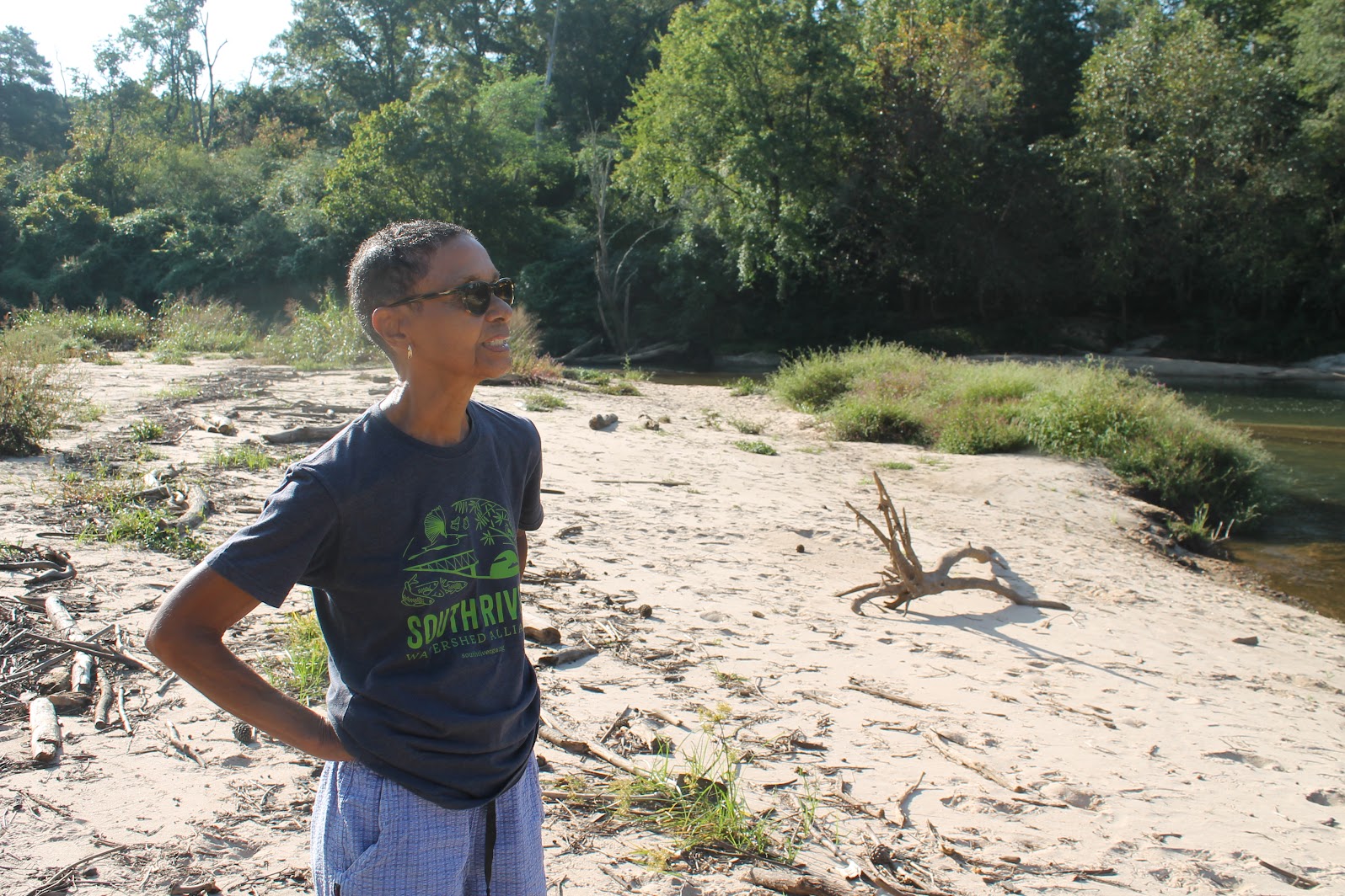 Dr. Jacqueline Echols shows off rehabbed Panola Shoals, a rustic kayak launch site that will be the beginning of South River Water Trail. Paige Penland/Hellbender Press
After years of activism, Atlanta’s South River is now a font of sustainability and fun
This article has been edited since its original publication.
ATLANTA — It has taken decades, but the once-polluted South River is now approved for fishing and recreation, and 40 navigable miles from Panola Shoals, about 30 minutes southeast of downtown Atlanta, to Lake Jackson, are being developed into the South River Water Trail for canoes and kayaks.
“This has always been an environmental justice issue,” said Dr. Jacqueline Echols, board president of the South River Watershed Alliance (SRWA) and driving force behind the cleanup.
The 60-mile South River begins in the 80-percent Black city of East Point, then runs through other predominately Black, South Atlanta communities and into Arabia Mountain Natural Heritage Area, where the Flat Rock Archives “preserves rural African-American history in Georgia.”
- south river watershed alliance
- garden & gun’s 2023 champion of conservation
- gacd 2023 urban conservationist of the year
- clean water act
- jaqueline echols
- arabia mountain natural heritage area
- flat rock archives
- south river water trail
- american rivers
- georgia conservation voters
- panola shoals
- keisha lance bottoms
- intrenchment creek
- rockdale river trail
- everett park
- environmental justice
Juneteenth: An Urgent Call for Climate Solutions
 ExxonMobil’s Baton Rouge, LA refinery, Feb. 11, 2016. Later that day, shortly before midnight, a massive fire broke out, bathing the night sky in an orange glow visible for miles around.
 ![]() Jim Brown/Flickr
Jim Brown/Flickr
Generations of Black Americans have faced racism, redlining and environmental injustices, such as breathing 40 percent dirtier air and being twice as likely as white Americans to be hospitalized or die from climate-related health problems.
AMERICA TODAY — This week, NPR’s Living on Earth podcast and illustrated transcript elucidates how relevant the broader meaning and historic context of Juneteenth is for all American citizens and residents.
Host Steve Curwood discusses with Heather McTeer Toney her new book, ‘Before the Streetlights Come On: Black America’s Urgent Call for Climate Solution.’
McTeer served as the Southeast Regional Administrator of the Environmental Protection Agency in the Obama administration and is now Executive Director of Beyond Petrochemicals. She argues that the quest for racial justice must include addressing the climate emergency and that the insights of people who experienced the negative health and socio-economic impacts of the petrochemical industry must be tapped to develop solutions that will work on the ground.
- juneteenth
- environmental justice
- racial justice
- heather mcteer toney
- social justice
- racism
- air pollution
- petrochemical
- petrochemical industry
- living on earth
- npr podcast
- slavery
- history of slavery
- climate emergency
- cancer alley
- steve curwood
- public health
- environmental racism
- mississipi river
- baton rouge
- black vote
- black and brown people
- interfaith power and light
- evangelical on the right
- religious leadership
- evangelicals for the environment
Carson-Newman professor hosts installment of worldwide “Climate Teach-in”
 Carson-Newman University Professor Brian Sohn is hosting a climate-oriented webinar on March 30. Thomas Fraser/Hellbender Press
Local installment of worldwide virtual Climate Teach-In is set for 2:30 p.m. March 30
JEFFERSON CITY — Brian Sohn had “the closest thing to a panic attack” when his second daughter was born.
He had long been alarmed by climate change and its potentially disastrous effects, but her arrival brought home the need to address the environmental challenges of a rapidly changing planet.
So now the Carson-Newman University education professor is putting some final touches on a virtual climate-related “teach-in” he’ll host from 2:30 to 3:30 p.m. Wednesday, March 30.
Tennessee Lookout: GOP legislators move to usurp even more local control with pro-pipeline bill
GOP-led Legislature aims to ban local decisions on fossil-fuel infrastructure
This story was originally published by Tennessee Lookout.
Per updated TL reporting, this bill was deferred to March 15 for committee consideration.
Memphis activist Justin Pearson spent years trying to pass legislation to protect his city’s natural drinking water, but a bill being fast tracked through the state Legislature is threatening his efforts.
Last week, environmental activists learned that Rep. Kevin Vaughan, R-Collierville, and Sen. Ken Yager, R-Kingston, are seeking to pass a bill aimed at removing local government control over land use zoning for fossil fuel infrastructure.
Both the Tennessee State House and Senate Commerce Committees will vote on HB2246 and SB2077 on Tuesday, and if the bill passes, it could be on the Legislature floor by Thursday.
Michaela Barnett wants to help break your consumer chains
 Michaela Barnett is the founder and owner of KnoxFill. She is seen here outside her South Knoxville home-based business in this submitted photo.
KnoxFill offers Knoxville home delivery and pickup of sustainably sourced personal-care products in refillable containers
Michaela Barnett has traveled the world, is an accomplished science writer and editor and is closing in on a doctorate from the University of Virginia.
Now she’s a business owner with a focus on sustainability and waste reduction and that has proven to be her true raison d’etre. She gets out of bed with joyous purpose and determination. And she sings to start her day.
“My husband says it’s like living with this annoying Disney character,” she said with a light laugh.
“I’ve got so much energy and joy and excitement,” said Barnett, who launched KnoxFill in March after eight months of research and preparation and works out of her home to fill multiple orders each day.
KnoxFill offers sustainably sourced personal-care items, detergents and other everyday household products in reusable glass containers for pickup or delivery. The product line includes shampoo, conditioner, body wash, lotions, laundry detergent, and dishwashing and castile soap. Barnett even offers safety razors, bamboo toothbrushes and refillable toothpaste “bites.”
- knoxfill
- reusable packaging
- sustainable product
- avoid packaging
- sustainable personal care item
- personal care delivery
- limit waste
- landfill
- incinerator
- fossil fuel
- refillable product
- personal care bottle refill
- environmental justice
- petrochemical product
- microplastic
- sustainable shopping
- consumerism
- consumer choice
- shopping
- green product
- conscientious shopper
Help tip the scales toward environmental justice for all: Here’s how
Make your voice heard for environmental justice
The White House Environmental Justice Advisory Council is seeking public input on a series of recommendations to the Biden Administration to address environmental justice issues across the United States. Air and water pollution caused by coal mining, toxic coal ash spills, and natural gas pipelines are a few examples of such problems in our region. These issues often impact low-income people and people of color the most, and there is a strong need for communities impacted by fossil fuels to build vibrant, diversified economies.
This is a chance for you to communicate your concerns about how these environmental issues impact disadvantaged communities while important policy decisions are under development!
The council will meet on May 13 to discuss:
-
Environmental justice policy recommendations to Congress and the Biden Administration;
-
A new Climate and Economic Justice Screening Tool, which will help identify disadvantaged communities and target federal funding;
-
Updates to a Clinton-era Executive Order (EO 12898) which directed federal agencies to address environmental justice issues in Black and Brown communities and among low-income populations.
Public comments will be accepted in writing until May 27. To submit a written comment, email This email address is being protected from spambots. You need JavaScript enabled to view it. .
Register to attend the meeting or submit your comment today!
Public comments will help to inform the future work of the White House Environmental Justice Advisory Council, and they will be incorporated into the record for federal agencies’ consideration.
Hellbender Press
The Environmental Journal of Southern Appalachia
Hellbender Press: The Environmental Journal of Southern Appalachia is a digital environmental news service with a focus on the Southern Appalachian bioregion. It aggregates relevant stories from across the news media space and provides original news, features and commentary.
Espousing the “Think Globally, Act Locally” ethos of FGS, Hellbender Press promotes the conservation and study of the environment and protections for air, water, climate, natural areas, and other resources that are critical to human health and a robust, resilient economy.
The Hellbender also champions civil and human rights, especially in matters of environmental justice, equity of access to natural resources and the right to a clean environment.
Hellbender Press is a self-organizing project of the Foundation for Global Sustainability’s Living Sustainably Program. All donations made for Hellbender Press to FGS are tax-deductible. We offer a free environmental news and information site, but grants and charitable contributions are encouraged and needed to support our work. Much of the content is provided on a volunteer basis by individuals and organizations that share a common cause.
Hellbender Press encourages the submission of original and relevant articles and photography for consideration to This email address is being protected from spambots. You need JavaScript enabled to view it..
For more details on the history and objectives of Hellbender Press, watch the interview of Thomas Fraser in Knoxille Community Media’s “Serving Knoxville” series.
- hellbender press
- the environmental journal of southern appalachia
- digital environmental news service
- southern appalachian bioregion
- news media
- original news
- civil rights
- human rights
- environmental justice
- inequity
- access to natural resources
- right to a clean environment
- human health and environment
- commentary
- conservation
- preservation
- advocacy
- common cause
- nonprofit organization